3D Mapping Service
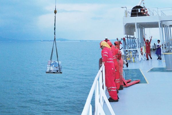
Our company stands at the forefront of technological innovation, offering high-precision 3D mapping services tailored specifically for ships and ship platforms. In the maritime industry, where precision and accuracy are paramount, our 3D mapping service provides an unparalleled level of detail and clarity. By utilizing state-of-the-art LIDAR (Light Detection and Ranging) technology, we are able to produce comprehensive digital models that serve as essential tools for planning, maintenance, and operational efficiency.
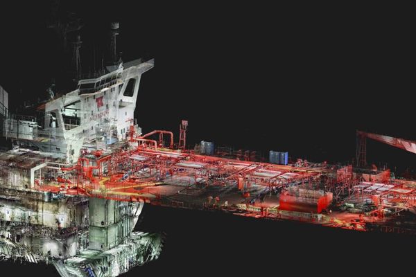
3D Mapping is an advanced technology that transforms the way maritime structures are managed and maintained. Through this technology, we create highly accurate and detailed digital models of ships and ship platforms. These models are not just visual representations but are critical for identifying structural integrity, assessing potential risks, and optimizing operational workflows. The ability to visualize a ship or platform in three dimensions allows for more informed decision-making, whether it's for routine maintenance or major repairs.
“Aldis Ship Repair has become one of our most trusted partners in the maritime industry. With their on-time delivery, high-quality workmanship, and professional team, they consistently add value to every project. Keeping our vessels operational has never been easier.”
Why Choose Us?
The process begins with the scanning of the surroundings of ships and ship platforms to create high-quality point clouds. These point clouds are dense collections of data points that represent the surfaces of the scanned object. Each point in the cloud is a precise measurement, capturing the exact dimensions and contours of the ship or platform. This data forms the foundation of our 3D models, ensuring that they are as accurate and detailed as possible. Our scanning technology is capable of capturing even the most intricate details, making it an invaluable tool for engineers, architects, and shipbuilders.
Once the 3D data is collected, our team of experts analyzes it to generate detailed reports that provide valuable insights into the condition and structure of the ship or platform. These reports are not just technical documents; they are actionable tools that guide maintenance, repairs, and upgrades. By analyzing the 3D models, we can identify areas that require attention, predict potential issues before they become critical, and ensure that any work carried out is based on the most accurate information available. Our reports are designed to be clear and comprehensive, providing all stakeholders with the information they need to make informed decisions.
With our extensive experience in the maritime industry, we bring advanced technology and deep industry knowledge to every project we undertake. Our 3D mapping services are designed to enhance the safety, efficiency, and operational performance of your ships and platforms. We understand the unique challenges of the maritime environment and are committed to providing solutions that meet the highest standards of accuracy and reliability.
We offer the best solutions for the safety and operational efficiency of your ships and platforms. By choosing our 3D mapping services, you are investing in the future of your maritime operations, ensuring that your assets are maintained and managed with the utmost precision. Contact us today to learn more about how our 3D mapping services can benefit your fleet.