Ecdis
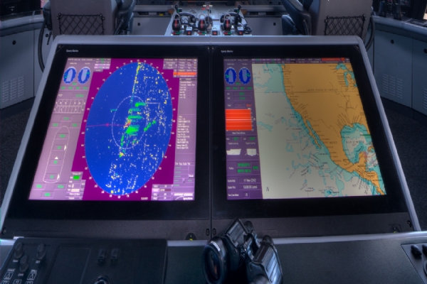
The Electronic Chart Display and Information System (ECDIS) is a state-of-the-art navigation system that utilizes computers to offer an advanced alternative to traditional paper maps. Developed in accordance with IMO rules, ECDIS is fully compliant with international maritime regulations and provides a critical tool for safe and efficient navigation. This system is designed to enhance navigational accuracy, reduce the likelihood of human error, and support the ship's crew in making informed decisions during voyages. By integrating various navigational data streams, ECDIS provides a comprehensive view of the ship's environment, greatly improving situational awareness.
ECDIS not only displays the ship's position relative to land but also integrates real-time data from multiple sources, such as GPS, radar, and automatic identification systems (AIS). This simultaneous information processing allows the system to automatically update and highlight any potential navigational hazards, such as submerged objects or nearby vessels, which may not be immediately visible. As a result, ECDIS acts as a powerful decision support tool, helping navigators make timely and accurate course adjustments to ensure safe passage. The system's ability to continuously monitor the ship's route and provide alerts significantly enhances the safety of maritime operations.
“Aldis Ship Repair has become one of our most trusted partners in the maritime industry. With their on-time delivery, high-quality workmanship, and professional team, they consistently add value to every project. Keeping our vessels operational has never been easier.”
Why Choose Us?
When operated by personnel who have undergone specialized training in ECDIS, the system offers numerous additional benefits to the ship's crew. One of the key advantages of ECDIS is its ability to facilitate more efficient voyage planning and execution. The system simplifies the process of chart updating, eliminating the need for manual corrections and reducing the workload on navigators. Furthermore, ECDIS enhances the accuracy of navigational charts by providing continuous updates, ensuring that the crew has access to the most current information. This not only improves navigational safety but also contributes to more efficient fuel use and voyage planning.
The ECDIS system's integration with the Electronic Navigational Chart (ENC) and various navigation sensors, including GPS, is essential for any modern ship. The system offers real-time access to detailed navigational data, allowing for precise route planning and execution. By utilizing ECDIS, ships can navigate complex routes with greater confidence, knowing that the system will provide timely warnings of any potential hazards. The combination of ECDIS with other navigational aids, such as radar and AIS, further enhances the safety and efficiency of maritime operations, making it an indispensable tool for any vessel.
Aldis Ship Repair Marine Service & Supply, our goal is to provide the best in safety, accuracy, and performance for your ship through our advanced ECDIS solutions. We understand the critical role that ECDIS plays in modern navigation, and we are committed to delivering systems that meet the highest standards of reliability and efficiency. Our team of experts is dedicated to ensuring that your crew is fully trained and equipped to utilize ECDIS to its full potential, providing you with the confidence to navigate even the most challenging routes.
We are dedicated to meeting your expectations for reliable routing and transportation. Our ECDIS solutions are designed to enhance the safety and efficiency of your maritime operations, ensuring that your voyages are conducted with the utmost precision and care. By choosing Aldis Ship Repair Marine Service & Supply, you are choosing a partner who is committed to excellence in every aspect of navigation and ship management.


